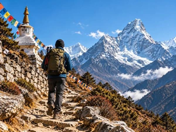
The Langtang Valley route has changed since the flash flood damage. See the updated 2026 Thulo Syabru loop itinerary, current trail conditions, permits, costs, and whether you need a guide.
Tamang Heritage and Langtang Valley Trek
Nepal
FromUS$850


The Langtang Valley route has changed since the flash flood damage. See the updated 2026 Thulo Syabru loop itinerary, current trail conditions, permits, costs, and whether you need a guide.
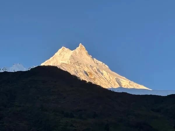
The Langtang Valley Trek is one of Nepal's most accessible high-altitude treks, and one of the most historically significant. Sitting just 60 kilometres north of Kathmandu, the valley offers genuine wilderness, dramatic views of Langtang Lirung (7,227m), and a route that has been progressively rebuilt and updated following a series of natural disasters that have reshaped the trail since 2015.
This guide reflects the current (2026) route from Thulo Syabru. It covers the updated itinerary, what has changed since the flash flood damage, current trail conditions, permits, costs, and what to expect on the ground. For a general overview of the trek, see our complete Langtang Valley Trek guide for 2026/27.
If you are planning a Langtang trek this season, this is the most current information available. Trail conditions and route access can change with seasonal flooding and maintenance work. Confirm the latest status with your guide or a local agency before you travel.

| Detail | Information |
|---|---|
| Start / End | Thulo Syabru (2,210m) |
| Highest point | Tserko Ri (4,984m) / Kyanjin Ri (4,773m) — optional side hike from Kyanjin Gompa |
| Kyanjin Gompa altitude | 3,870m |
| Duration | 7 days trekking + 1 day drive each way |
| Difficulty | Moderate - suitable for fit beginners with good preparation |
| Permits required | Langtang National Park entry permit |
| Best months | October to November; March to May |
| Max group size | No restriction, but smaller groups move faster on rebuilt trail sections |
| Guide required | Not legally mandatory, but strongly recommended post-flood route changes |
Langtang Valley has been reshaped by two major events. The 2015 Gorkha earthquake triggered a catastrophic avalanche that buried Langtang village, killing more than 350 people including trekkers and local residents. The village was subsequently rebuilt on higher ground, and the trail was reopened.
More recently, flash flooding along the Langtang Khola has damaged sections of the lower valley trail. Seasonal flooding is a recurring reality in the Himalayan foothills. During high monsoon periods, the river corridor between Bamboo and Lama Hotel is particularly exposed. Some sections of the older trail along the riverbank have been partially washed out or rerouted, and several suspension bridges have been replaced or relocated.
The practical effect for trekkers is a route that looks slightly different from older guidebooks and pre-2020 trip reports. The distances between stages are largely the same. What has changed is the line of the trail in places, the condition of certain bridge crossings, and the recommended starting point.
Starting from Thulo Syabru (2,210m) rather than Syabrubesi (1,503m) has several advantages for the updated route. It avoids the lowest and most flood-exposed sections of the valley approach. It also creates a true loop, making the return leg more varied than a simple backtrack.
The following itinerary reflects the current route from Thulo Syabru. All altitudes are approximate.
The drive from Kathmandu to Thulo Syabru takes approximately 7-8 hours via the Prithvi Highway to Trishuli, then north through Dhunche to Thulo Syabru village. The road is paved to Dhunche and becomes a rougher mountain track for the final section. Thulo Syabru sits on a ridge above the Langtang Khola valley, giving you your first views of the mountains to the north.
Accommodation in Thulo Syabru is in guesthouses on the ridge. Arriving before dark matters here — the village layout is not intuitive at first.
The trail descends sharply from Thulo Syabru into the Langtang Khola valley, passing through bamboo forest and crossing the river before the long climb to Lama Hotel. This stage involves more descent than ascent but is tiring because the valley floor section is warm and humid.
Bamboo (1,960m) is a common lunch stop with several teahouses. From here, the trail climbs steadily to Lama Hotel (also called Rimche). The rebuilt trail section between Bamboo and Lama Hotel follows a higher line in places to avoid the flood-affected riverbank route. Your guide will point out where the old and new trail diverge.
Note: This section of trail passes through the most flood-affected corridor. The suspension bridge near Bamboo was replaced following damage. Confirm its current status with your agency before departure, particularly if travelling after heavy monsoon rains.
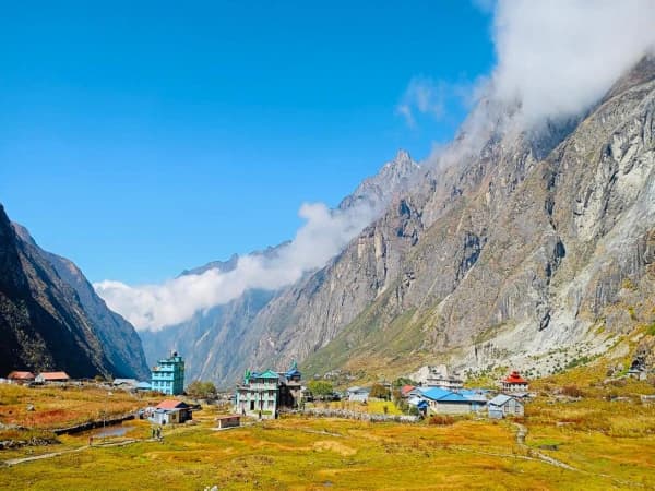
This is the most rewarding day in terms of scenery. The trail stays high above the river and climbs gradually through rhododendron and pine forest before opening up to the wide, flat valley floor. Langtang Lirung (7,227m) dominates the horizon ahead.
Langtang village is the rebuilt settlement above where the original village stood before 2015. It is smaller and quieter than pre-earthquake accounts describe, but it functions well as a trekking hub with multiple teahouses. The memorial chorten near the new village marks the site of the original settlement and is worth visiting. It is a place to be respectful.
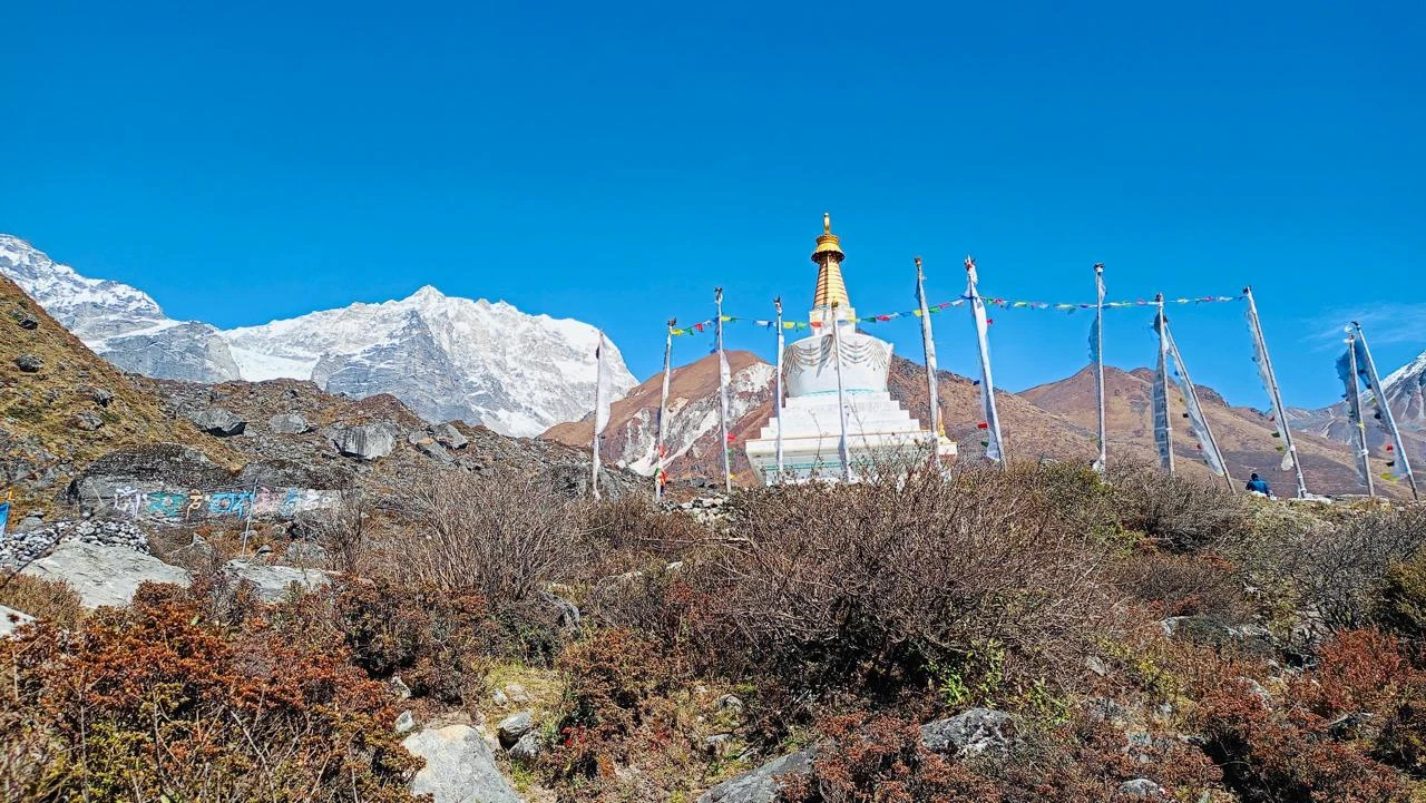
A short but altitude-gaining stage. The trail is clear and well-marked. Kyanjin Gompa is the de facto endpoint of the Langtang Valley Trek for most groups. The gompa itself dates back several centuries and is one of the oldest Buddhist monasteries in the region.
The famous Kyanjin cheese factory produces yak cheese and butter using traditional methods. It is open to visitors and worth the stop. Take time to acclimatize at 3,870m before any side hikes.

Most trekking groups spend two nights at Kyanjin Gompa. The standard side hike is Kyanjin Ri (4,773m), a 3-4 hour round trip with exceptional views of the Langtang range, Gangchenpo, and on clear days the peaks toward Tibet. The longer and more demanding option is Tserko Ri (4,984m), which adds another 2-3 hours but is one of the finest viewpoints in the entire Langtang region.
Neither hike requires technical climbing ability, but both involve loose terrain above 4,500m. Trekking poles are strongly recommended. Assess your condition honestly before committing to Tserko Ri.
The descent covers the Day 3 and Day 4 stages in reverse. Moving downhill is faster, but altitude loss after multiple nights above 3,500m can cause fatigue earlier than expected. Lunch at Langtang village is typical. The goal is Lama Hotel for the night.
The final trekking day climbs from Lama Hotel back through the Bamboo section and up to Thulo Syabru. This uphill return is the leg that distinguishes the Thulo Syabru loop from the older Syabrubesi route. It is a sustained but manageable climb through forest. Most trekkers complete it well within the day. Overnight in Thulo Syabru.
The return drive to Kathmandu takes approximately 7-8 hours. Departure should be early to arrive before dark, particularly in October and November when daylight ends around 5:30pm.
The Langtang trail is in good condition for the October-November 2026 season on the higher sections. The gompa to Langtang village stretch and the Langtang village to Lama Hotel section are well-maintained.
The lower valley corridor between Bamboo and Lama Hotel carries the most flood risk and should be assessed by your agency before you set out, particularly if you are travelling in the weeks immediately after monsoon season ends (late September to early October). By mid-October, conditions are normally stable.
New bridges are in place but vary in quality. Some are fully constructed suspension bridges; others are simpler log crossings. A guide who has recently trekked the route will know the current status of each crossing.

One permit required for the Langtang Valley Trek:
Approximate total trek costs per person for a guided group trek with Nepal Guide Trekking:
| Cost Item | Approximate Cost (USD) |
|---|---|
| Agency package (guide, porter, teahouse accommodation, meals) | US$550 |
| National park permit | USD 22 (approx.) |
| Transportation (Kathmandu - Thulo Syabru return) | Included in most agency packages or approx. USD 30-40 private vehicle |
October and November are the best months. Post-monsoon skies clear quickly in Langtang and the trail is dry. The valley is less crowded than Annapurna or EBC routes, so you get high-quality conditions without the queues.
Spring (March to May) is the second season. Rhododendron blooms from late March through April, and temperatures are comfortable. The trade-off is afternoon cloud building earlier in the day.
Winter trekking (December to February) is possible but cold at altitude. Kyanjin Gompa can drop to -15C at night. Accommodation and teahouses may have limited availability.
Avoid July and August. Monsoon season brings heavy rain, leeches on the lower trail, and elevated flood risk in the Langtang Khola corridor.

The Langtang Valley Trek is rated moderate. The highest sleeping altitude is Kyanjin Gompa (3,870m), which is lower than the base camps on EBC or Manaslu. Altitude sickness is possible above 3,000m but the risk is manageable with the 7-day itinerary, which builds altitude gain gradually.
The main physical demand is sustained daily walking, typically 5-7 hours per day on uneven terrain. There are no technical sections and no glacier crossings on the main route. The steepest sections are the descent from Thulo Syabru into the valley on Day 2 and the return climb on Day 7.
Preparation: a minimum of 3-4 weeks of regular cardio exercise (hiking, running, cycling) before departure makes a significant difference to how comfortable you find the trek.
Langtang is not a restricted trekking area, so a licensed guide is not legally required. However, given the post-flood route changes, a guide who has recently completed the trek is genuinely valuable. Sections of trail between Bamboo and Lama Hotel can be ambiguous, and some older route markers point to paths that no longer exist or have been rerouted above the flood line.
A porter-guide combination costs approximately USD 25-30 per day and handles logistics including teahouse bookings. For a 7-day trek, this is a relatively modest addition to the total cost.
For solo trekkers unfamiliar with Nepal, a guide also provides the fastest response if trail conditions deteriorate unexpectedly.

Yes, the trail is open and operational for the 2026 season. Flood damage to lower valley sections has been repaired and bridges are in place. The upper valley from Lama Hotel to Kyanjin Gompa is unaffected by flood damage. As with any Himalayan trek, conditions can change. Confirm the latest status with your agency in Kathmandu before departure.
Thulo Syabru (2,210m) sits at a higher elevation than Syabrubesi (1,503m) and sits away from the lowest, most flood-exposed section of the valley approach. Starting here creates a true loop itinerary, avoids the need to walk the same riverbank trail twice, and means the final day climbs back to a road-accessible point without descending further into the valley.
Approximately 7-8 hours by private vehicle. The road goes via Trishuli and Dhunche. Road conditions are good to Dhunche and variable on the final mountain track to Thulo Syabru. Your driver will know the road.
Technically yes, but Kyanjin Gompa is the destination that makes this trek worthwhile. The monastery, the yak cheese factory, and the high-altitude side hikes to Kyanjin Ri or Tserko Ri are what distinguish Langtang from a simple valley walk.
Yes. A new village has been constructed on higher ground above the site of the original settlement, which was buried in the 2015 avalanche. The new village has functional teahouses and guesthouses. The memorial chorten at the old village site remains and is accessible on foot.
Langtang is one of the most underrated treks in Nepal for international visitors. EBC and Annapurna Circuit dominate the marketing, but Langtang offers comparable scenery, shorter approach, fewer crowds, and a route that carries significant human and natural history.
The updated Thulo Syabru loop is a well-designed itinerary that accounts for the current trail reality. It is not a compromise route. It is a better-designed route for the valley as it exists now.
To book a guided trek or for current route conditions, contact Nepal Guide Trekking based in Kathmandu. The team has current, first-hand knowledge of trail status and can confirm conditions for your specific travel dates.