.webp&w=3840&q=75&dpl=dpl_B9HN3YrMrJQwNjo1FKGG4G4Pd8Mi)

Most trekkers choose one or the other. This itinerary does both.
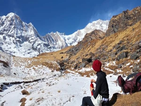
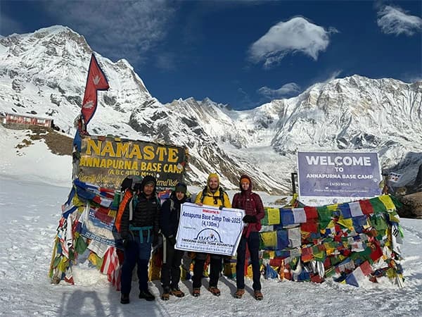
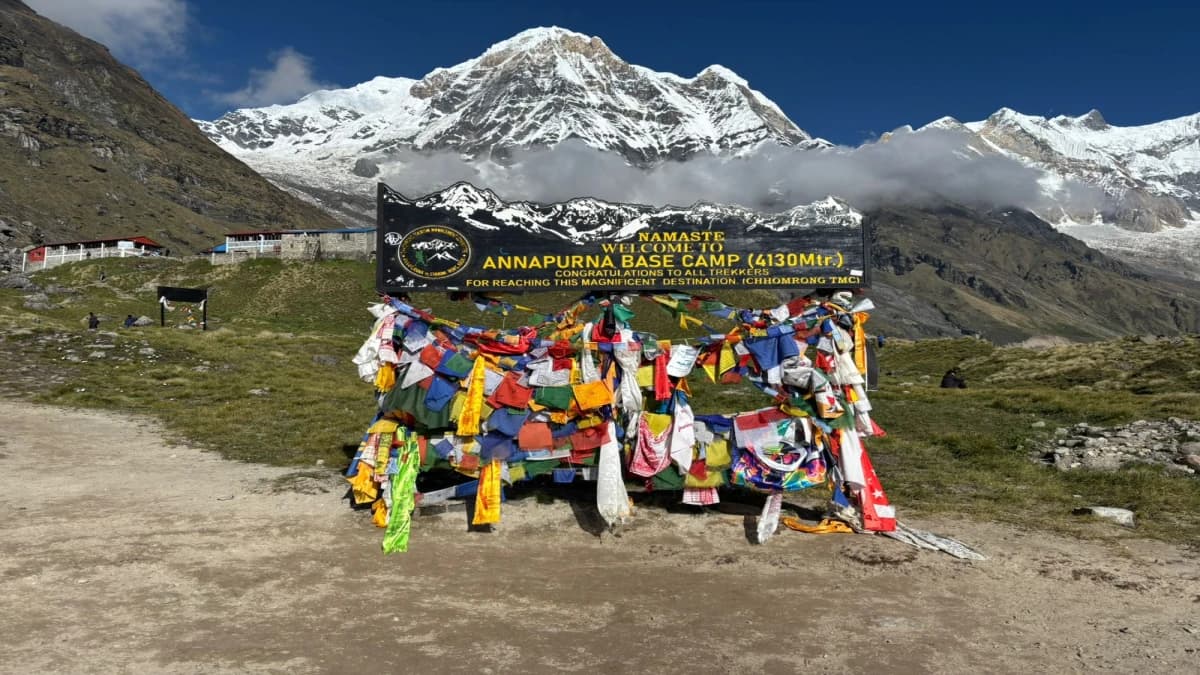
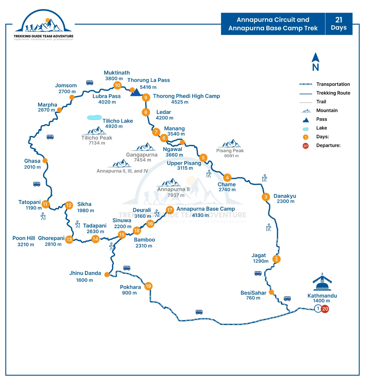
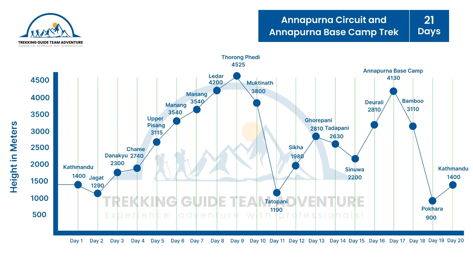
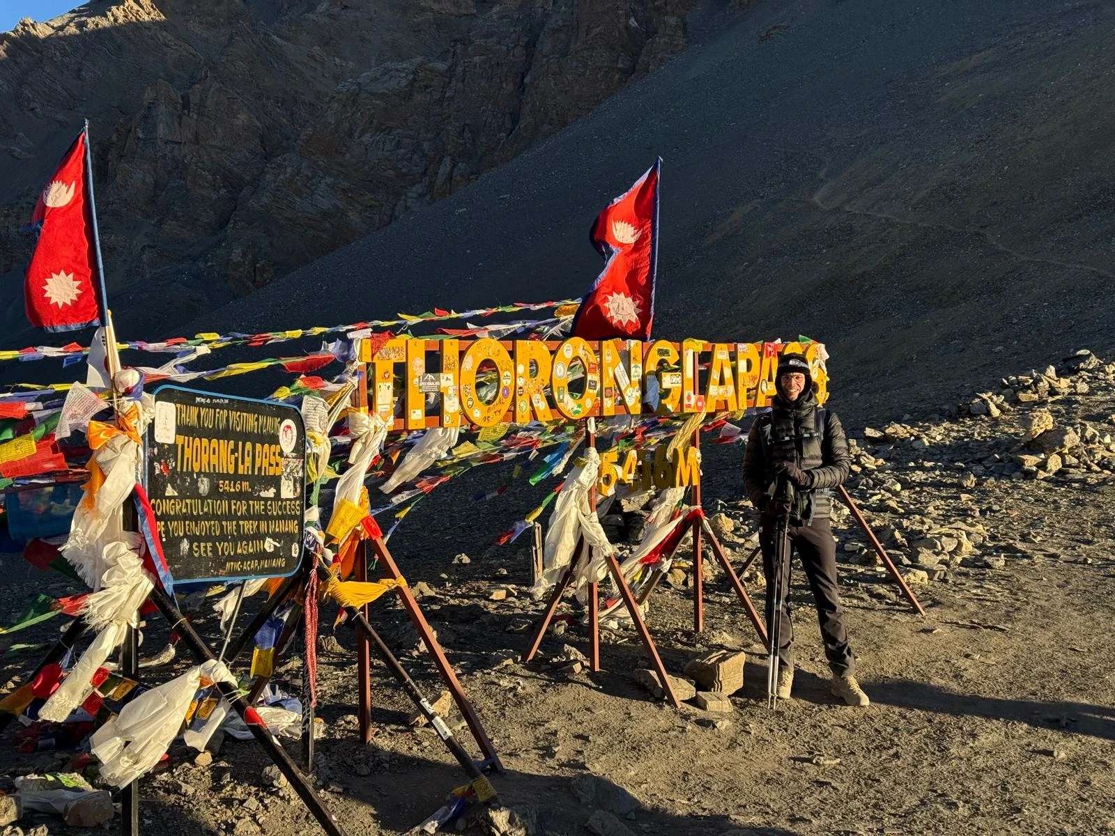
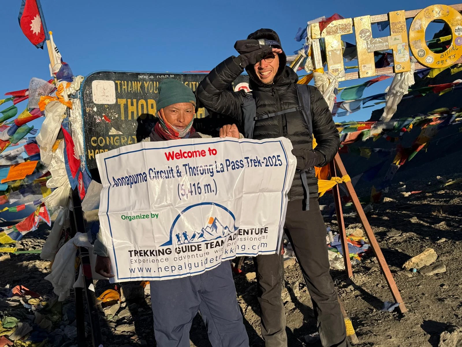
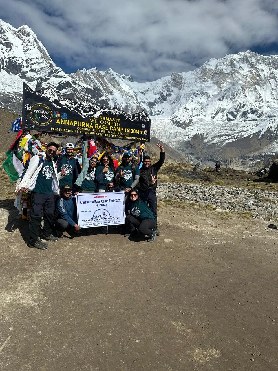
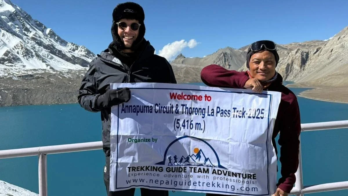
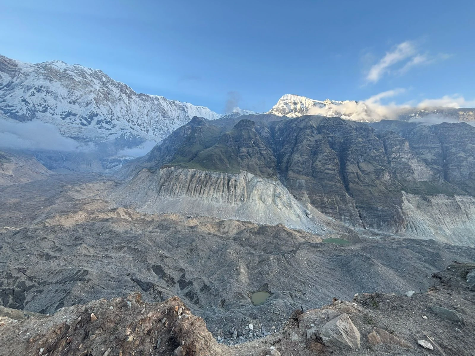
Over 21 days, you complete the full Annapurna Circuit — crossing Thorong La Pass at 5,416m, the highest mountain pass in Nepal — then continue south through the Kali Gandaki gorge, climb to Poon Hill for sunrise over Dhaulagiri and the Annapurna range, and finish by pushing deep into the Annapurna Sanctuary to reach Annapurna Base Camp at 4,130m — two of the greatest treks in the Himalayas, connected into one continuous journey.
This is a serious undertaking. You will walk 6 to 9 hours most days across 21 consecutive trekking days, reaching above 5,400m altitude at the highest point. It rewards trekkers who are well prepared physically and want the full picture of what the Annapurna region has to offer.
Annapurna Circuit and Base Camp Trek — Highlights
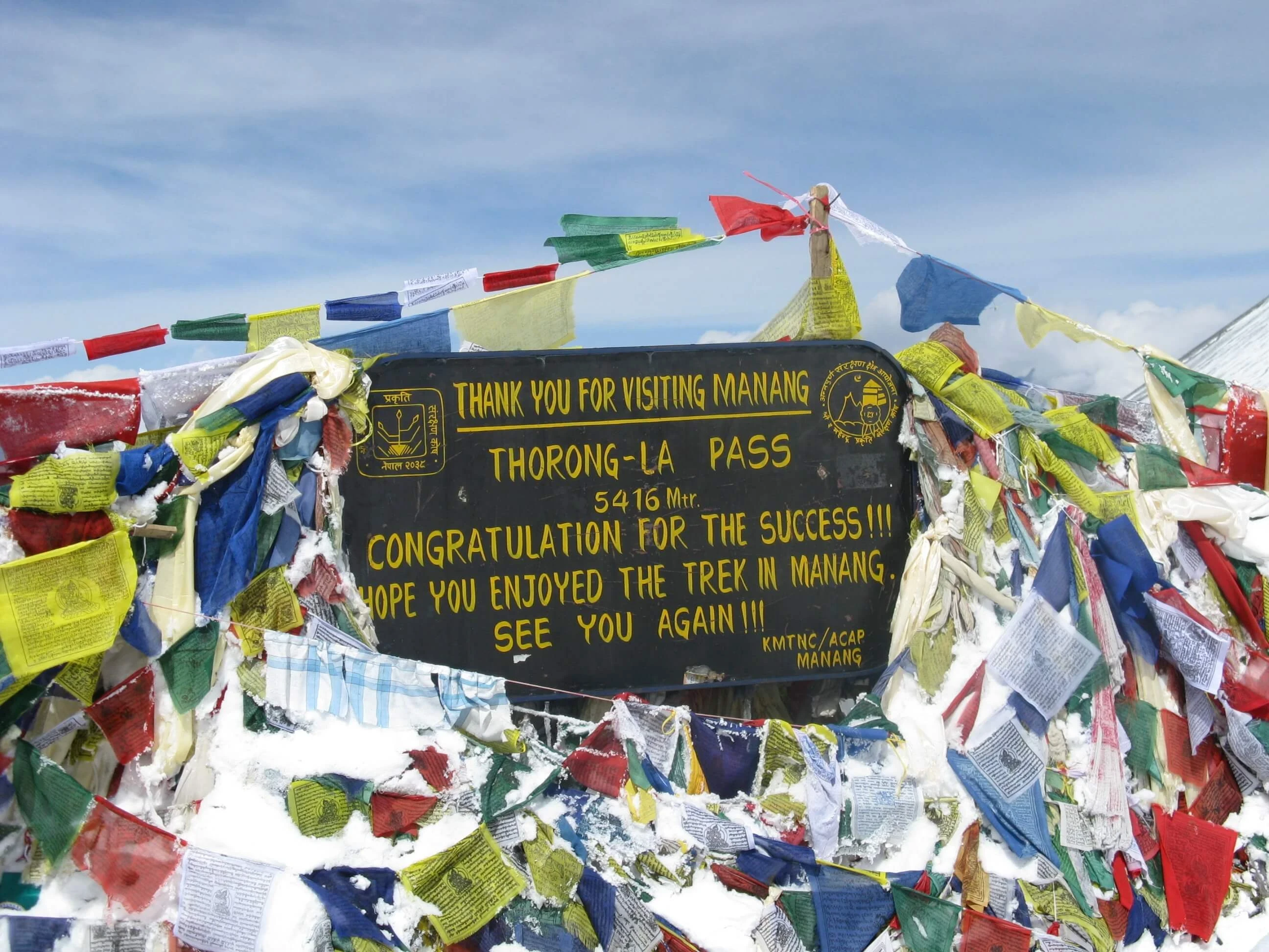
- Cross Thorong La Pass (5,416m) — the highest pass on the Annapurna Circuit and one of the most celebrated high-altitude crossings in the Himalayas
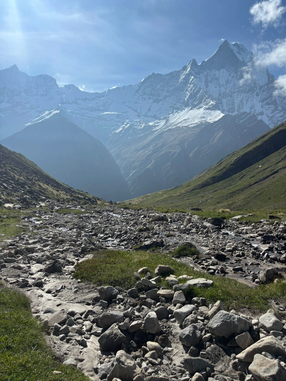
- Complete the full circumnavigation of the Annapurna massif through diverse landscapes: subtropical forest, alpine meadows, and high-altitude desert
- Sunrise at Poon Hill (3,210m) — panoramic views of Dhaulagiri, Machhapuchhre, Annapurna South, and Hiunchuli in first light
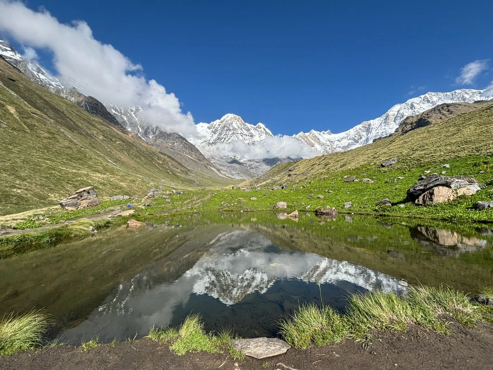
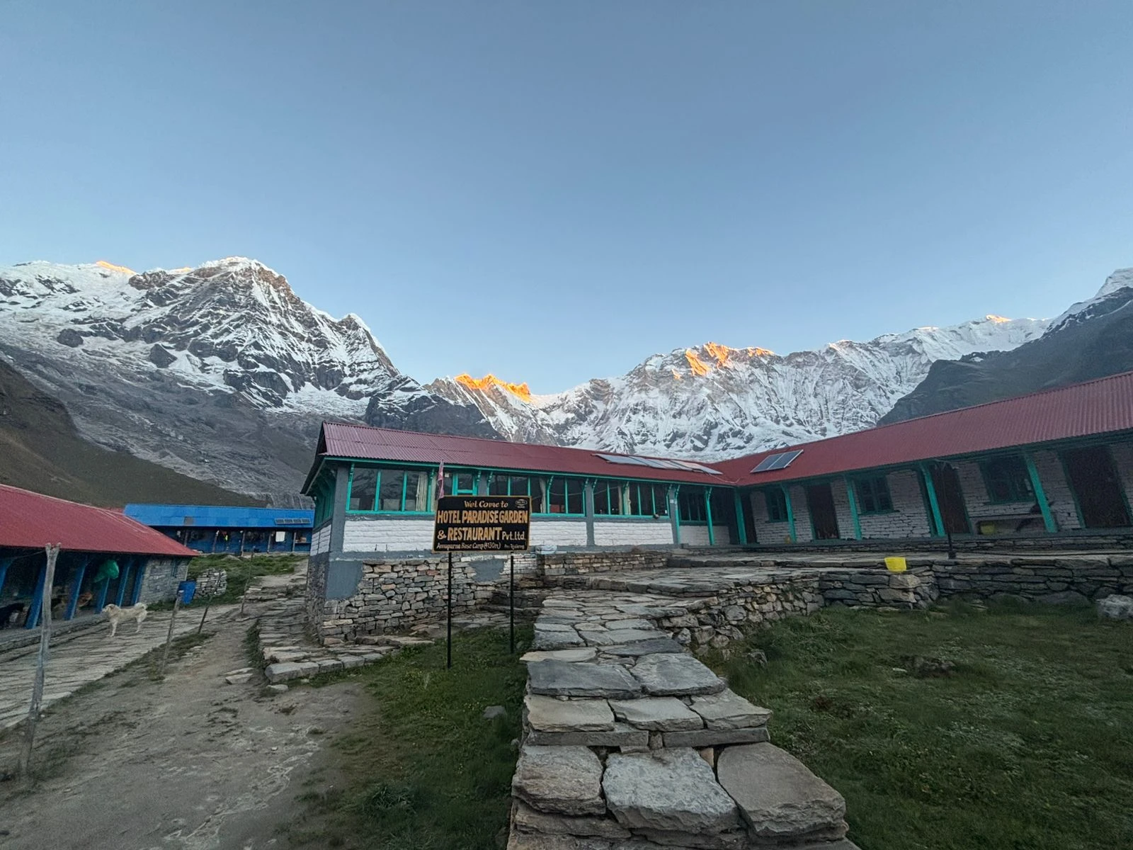
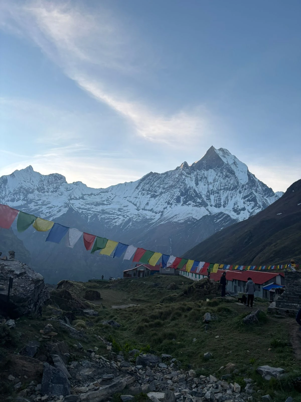
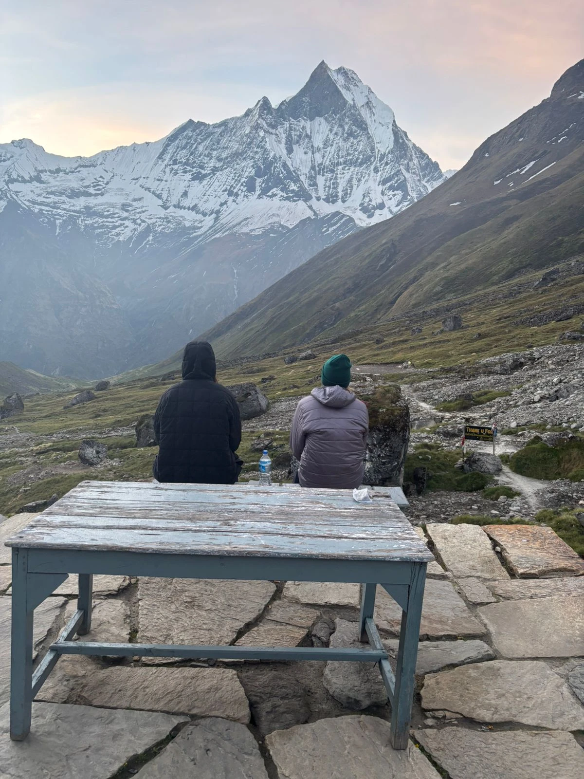
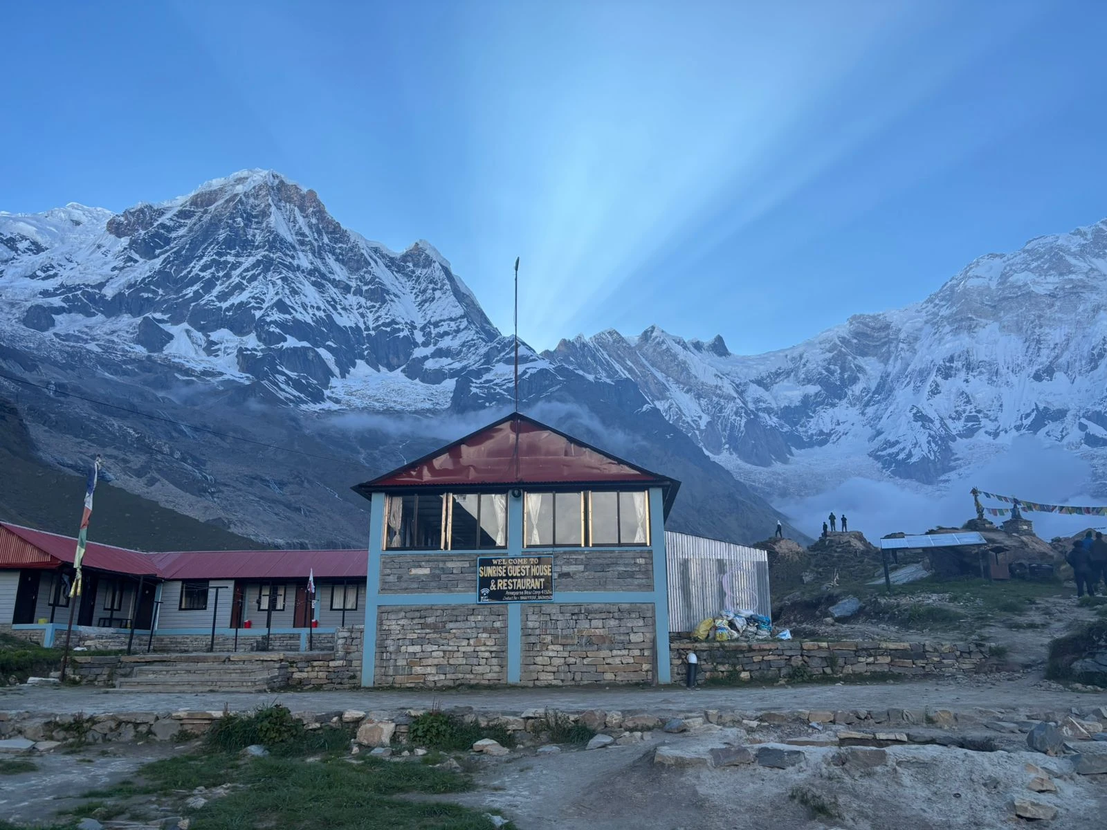
- Stand at Annapurna Base Camp (4,130m) inside a glacial amphitheater ringed by nine peaks above 7,000m
- Trek through the Kali Gandaki Gorge — the world's deepest river gorge between Dhaulagiri and Annapurna
- Visit Muktinath Temple — sacred to both Hindus and Buddhists, with eternal flame and 108 water spouts
- Acclimatization day in Manang with optional hike to Gangapurna Lake or Braga Monastery
- Soak in natural hot springs at Tatopani after crossing the high-altitude pass section
- Walk through Gurung, Magar, Thakali, and Manangi villages — one of the most culturally diverse trekking corridors in Nepal
- Experienced local English-speaking guide throughout — all permits and logistics handled

Annapurna Circuit and Base Camp Trek Difficulty
This is a strenuous trek rated for experienced trekkers. The 21-day itinerary combines two of Nepal's most demanding routes into one continuous journey, with significant altitude exposure and no real rest after Day 7.
Trek Difficulty Rating: Strenuous - What That Means
- Daily walking time averages 6 to 9 hours across most days
- 21 consecutive trekking days with only one acclimatization rest day in Manang
- Maximum altitude of 5,416m at Thorong La Pass — nearly 3x higher than the highest point in the Alps
- Total elevation gain across the full route exceeds 20,000m cumulatively
- Terrain varies from subtropical jungle to alpine scree, rocky moraine, and snow on the pass
- Thorong La crossing day involves 8 to 9 hours of walking, starting at 3 am to 4 am
Physical Fitness Required for the Annapurna Circuit
- Must be able to walk 8 to 12km per day carrying a daypack (5 to 7kg) over multiple consecutive days
- Prior multi-day high-altitude trekking experience is strongly recommended — this is not a suitable first Nepal trek
- Good cardiovascular fitness is more important than raw strength — build your aerobic base before arriving
- Training should include regular hiking on inclines with a loaded pack for at least 8 weeks before departure
- Knee strength matters — the descent from Thorong La drops 1,600m, and the Chhomrong staircase is hard on joints
Is the Annapurna Combined Trek Right for You?
This trek is not suitable for:
- First-time trekkers without prior multi-day hiking experience above 3,000m
- Anyone with pre-existing heart, lung, or blood pressure conditions
- Trekkers who cannot commit to the full 21 days — the itinerary cannot be safely shortened once above Manang
- Anyone unwilling to carry comprehensive travel insurance, including helicopter rescue coverage
Best Time for the Annapurna Circuit and Base Camp Trek
Two windows work for this itinerary. Everything else carries significant risk.
October to November — Best Season
- Clear, stable weather across the entire Annapurna region
- Excellent mountain visibility — Dhaulagiri, Annapurna I, Machhapuchhre, and Manaslu all visible on most days
- Thorong La Pass is reliably open and snow-free in October and early November
- Temperatures at high altitude range from -5°C to 10°C during the day at Thorong La — cold but manageable
- Busiest season — book teahouse accommodation in advance for the Manang and Thorong Phedi sections
- October is the sweet spot: post-monsoon clarity without the winter cold
March to May - Good Season
- Rhododendron forests below 3,500m are in full bloom — one of the most visually striking times on the lower trail
- Slightly warmer than autumn — more comfortable at lower elevations
- Some afternoons, clouds build in May, reducing summit visibility
- Thorong La is reliably open from mid-March onwards
- Less crowded than October, but still busy at the main teahouse stops
December to February - Not Recommended
- Thorong La Pass frequently closes completely due to snow accumulation and ice
- Temperatures at Thorong Phedi can drop to -20°C overnight
- Avalanche risk increases significantly above Manang
- Several teahouses on the upper circuit close for the winter season
June to September - Not Recommended (Monsoon)
- Heavy rainfall makes lower-elevation trails slippery, muddy, and leech-infested
- Landslides can block the Jagat to Danakyu road section
- Mountain views are consistently blocked by clouds throughout the monsoon period
- The Annapurna Sanctuary section (Days 15 to 19) sees the highest avalanche risk during monsoon season
Altitude Profile and Acclimatization Strategy
Altitude sickness is the most significant safety risk on this trek. Understanding how the itinerary manages altitude progression is important before you book.
Day-by-Day Altitude Gain on the Annapurna Trek
- Days 1 to 6 climb gradually from 1,290m to 3,540m — a safe gain of roughly 400 to 500m per day
- Day 7 is a mandatory acclimatization rest day in Manang (3,540m) — the most important day on the trek
- Days 8 to 9 climb from 3,540m to 4,525m, with an optional hike to High Camp (4,925m) for extra acclimatization
- Day 10 summits at 5,416m on Thorong La Pass, then drops to 3,800m at Muktinath — a 1,600m same-day descent
- Days 11 to 19 descend progressively to 1,760m, with no further altitude challenges after Thorong La
Altitude Sickness Symptoms to Watch for Above 3,000m
- Common symptoms above 3,000m: headache, nausea, loss of appetite, poor sleep, fatigue
- These are normal in mild form. They become dangerous when they progress to confusion, loss of coordination, or fluid in the lungs
- The Himalayan Rescue Association operates a clinic in Manang with daily altitude-sickness talks — all trekkers on this route should attend
- Diamox (acetazolamide) is commonly used by trekkers as a preventive measure — consult a doctor before your trip
- The golden rule: never ascend with worsening symptoms. Descent is the only reliable cure for serious AMS
How the 21-Day Itinerary Manages Altitude Risk
- Gradual ascent profile with no days exceeding 600m net elevation gain before Thorong Phedi
- Mandatory rest day in Manang at 3,540m before any further ascent
- Optional High Camp stay or afternoon hike on Day 9 for additional pre-pass acclimatization
- All guides are trained in high-altitude first aid and carry supplemental oxygen and medical kits
- Helicopter evacuation is available from most points on the route — personal rescue insurance is required
Annapurna Trekking Permits: ACAP Card
One permit is required for this trek. It is included in the package price and arranged by Trekking Guide Team Adventure before your departure.
ACAP Permit - Annapurna Conservation Area Permit
- Required for all trekkers entering the Annapurna Conservation Area, which covers the entire route
- Cost: NPR 3,000 per person (approximately USD 22) — included in package
- Must be shown at multiple checkpoints along the route — carry it accessible, not buried in your bag
- ACAP funds conservation efforts and community development in the Annapurna region
- Permits are obtained at the Nepal Tourism Board office in Kathmandu before the drive to Jagat
No Additional Restricted Area Permits Required
- The standard Annapurna Circuit and Base Camp route does not pass through any restricted area
- No special area permits, no Mustang permit, no additional fees on the standard route
- If you wish to extend the trek into Upper Mustang from Muktinath, a separate restricted area permit (USD 500 for 10 days) would be required — this is not part of this itinerary
Cultural Highlights: Villages, Monasteries, and Temples on the Annapurna Trek
The Annapurna Circuit passes through one of the most ethnically and culturally diverse corridors in Nepal. This is not just a mountain trek — it is a journey through communities that have lived in the high Himalayas for centuries.
- Gurung villages (lower Annapurna region) — the trail from Tadapani to Chhomrong passes through the heartland of Gurung territory. The Gurung people are one of Nepal's major hill communities, historically serving in the British and Indian Gurkha regiments. Their festivals, cuisine, and traditional architecture are distinct.
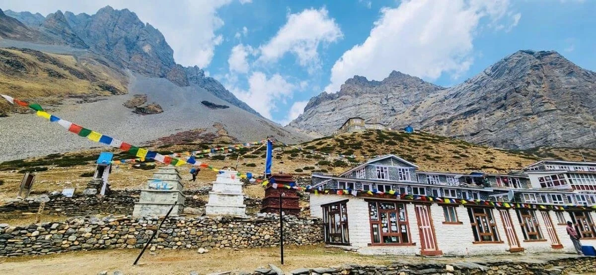
- Manangi villages (upper circuit, Manang Valley) — the Manangi community is known as traders who historically traveled as far as Thailand and Hong Kong. Manang village has a medieval quality — flat-roofed stone houses, narrow alleys, and a vibrant monastery complex.
- Thakali villages (Tatopani to Jomsom area) — the Thakali are Nepal's most famous mountain innkeepers and cooks. Tatopani and the Kali Gandaki corridor pass through Thakali country. Their apple brandy, buckwheat bread, and yak butter tea are trail staples.
- Muktinath Temple — one of the most sacred sites in Nepal, revered by both Hindus and Buddhists. The temple complex sits at 3,800m with 108 water spouts, an eternal flame fed by natural gas, and a Buddhist monastery. Pilgrims come from across South Asia to bathe here.
- Braga (Barga) Monastery, Manang — one of the oldest Buddhist monasteries in the Annapurna region, dating back more than 500 years. The interior holds ancient thangka paintings, bronze statues, and thousands of manuscripts.
- Poon Hill viewpoint (3,210m) — Ghorepani and the surrounding ridge are in the heartland of Gurung country, with traditional rhododendron-wood architecture and a community that has served trekkers since the 1980s. The Poon Hill viewpoint sunrise draws trekkers from across the world.
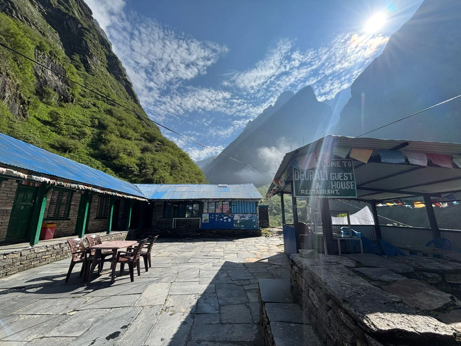
Teahouse Food and Accommodation on the Annapurna Trek
Teahouse Accommodation on the Annapurna Circuit
- Accommodation throughout the trek is in teahouses — family-run guesthouses built for trekkers
- Standard rooms have two single beds with a mattress, pillow, and blanket — bring a sleeping bag liner
- Bathroom facilities are usually shared. Hot showers are available at most stops for USD 1 to 3 extra
- WiFi is available at most teahouses below 4,000m for a small fee. Above 4,000m, connectivity is unreliable
- In peak season (October to November), private rooms fill quickly at Manang, Thorong Phedi, and Chhomrong — your guide will book ahead where possible
- Above 4,500m at Thorong Phedi, accommodation is very basic — bring a warm sleeping bag rated to at least -10°C
Food on the Annapurna Trek: What to Expect
- Teahouse menus are extensive by Himalayan standards — dal bhat, pasta, fried rice, soups, momos, pizza, pancakes, and oatmeal are all common
- Dal bhat (rice, lentil soup, vegetable curry) is the best value and most nutritious option on the trail — it is also unlimited refills at most teahouses
- Food prices increase with altitude — budget USD 3 to 5 per meal in the lower sections, USD 6 to 10 above 3,500m
- Breakfast, lunch, and dinner are included in the package throughout the trek. Drinks (tea, coffee, water) are not included
- Vegetarian options are available everywhere. Vegan and gluten-free options are possible at lower elevations but limited above 4,000m
- Carry energy snacks (nuts, bars, chocolate) for the Thorong La crossing day when teahouse food is minimal
What to Pack — Essential Gear
A sleeping bag and duffle bag are included in the package. Everything else listed below should be brought or rented in Kathmandu or Pokhara before the trek begins.
Clothing and Layering System for High Altitude Trekking
- Base layers (thermal long-sleeve top and leggings) — merino wool or synthetic, 2 sets
- Mid layer — fleece or down jacket for evenings above 3,000m
- Outer shell — waterproof, windproof jacket and trousers
- Down jacket — essential above 4,000m and for the Thorong La crossing
- Trekking trousers — 2 pairs, preferably zip-off for lower elevations
- Warm hat and sun hat — you will use both
- Gloves — thin liner gloves plus waterproof outer mitts for the pass
- Wool or synthetic trekking socks — at least 4 to 5 pairs
Trekking Boots and Footwear for the Annapurna Circuit
- Waterproof trekking boots with ankle support — must be broken in before the trek, not brand new
- Camp sandals or light shoes for teahouse evenings
- Gaiters for the Thorong La section if trekking in shoulder season when snow is possible
Essential Trekking Equipment and Accessories
- Trekking poles — highly recommended for the Thorong La descent and the Chhomrong staircase
- Headlamp with spare batteries — essential for the 3 am Thorong La start
- Water bottles (2 x 1 litre) or a hydration bladder — purification tablets or a filter for refilling from streams
- Sunscreen SPF 50+ and UV-protective sunglasses — UV intensity is extreme at altitude
- First aid kit including altitude sickness medication (Diamox) — consult your doctor about Diamox before departure
- Portable power bank — teahouse charging is not always reliable above 3,500m
- Lightweight daypack (25 to 30 litres) for the daily trail while the porter carries your main bag
- Most items above can be rented or purchased at good quality in Kathmandu's Thamel district if you prefer to travel light.

vvrw-1-1.webp)
vbe-1-1.webp)
.webp)
.webp)
.webp)
.webp)
.webp)
.webp)
.webp)
vbe-1-2.webp)
vvrw-1-2.webp)